
User Engagement Suite
Smart Tools. Local Insights. Community-Powered Accessibility.
Access Trails UK goes beyond listings; we’re collecting a living, evolving platform to help you find, plan, and enjoy accessible paths across the UK. With powerful tools and contributions from our growing community, finding your next path is easier and more inclusive than ever.
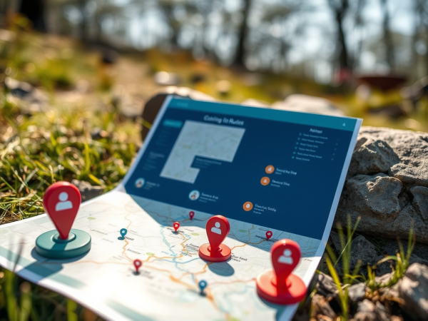
Interactive Map with Smart Filters
Browse the interactive map to explore verified accessible paths across the UK. Use built-in filters to find paths that suit your exact needs and preferences.
Filter by:
- Surface type (paved, gravel, boardwalk)
- Accessibility features (wheelchair access, Blue Badge parking, accessible toilets)
- Distance and estimated duration
- Region or postcode
- Terrain level (flat, gentle incline)
Find a Path Near Me
Powered by GPS & Browser Location
Let the outdoors come to you. With our “Walks Near Me” feature, you can use your current location to discover nearby accessible routes perfect for spontaneous strolls, weekend getaways, or travel planning.
How it works:
- Enable location access in your browser or device
- Instantly view nearby paths on a map or list view
- Click through for full accessibility details
Community Uploads & Path Sharing
Contribute Your Favourite Routes
We believe local knowledge creates the best experiences. Share your discoveries with others by uploading:
- GPX files – Easily add your route to our map
- Photos – Show others what to expect
- Reviews & Tips – Help fellow people with honest insights about accessibility, facilities, and highlights
Share a Path
All community submissions are moderated to ensure quality and accuracy.
Every tool we build is designed to make outdoor exploration more accessible, practical, and enjoyable for everyone. With your input and feedback, Access Trails UK continues to grow into a trusted hub for inclusive paths across the UK.
