Route Overview
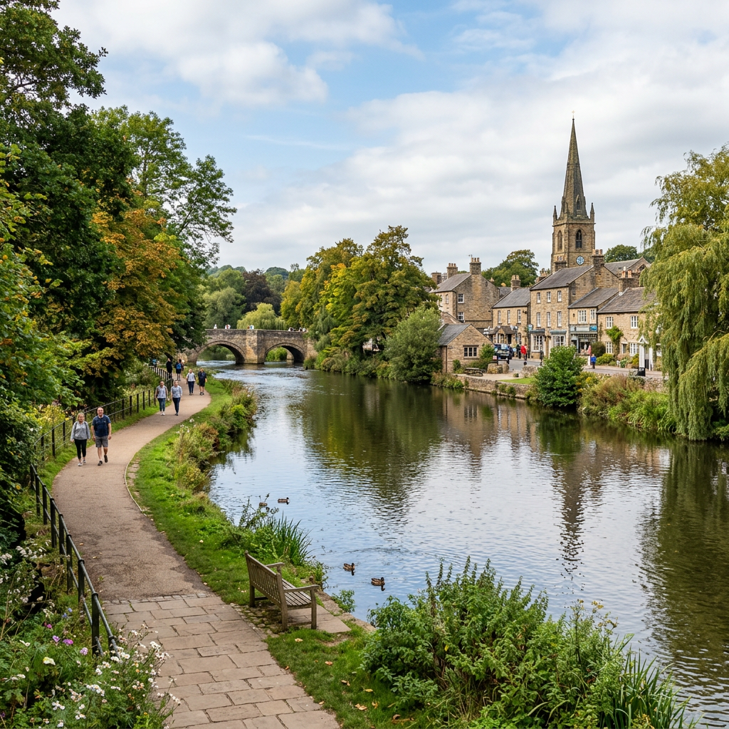
Bakewell’s riverside path offers a gentle, accessible stroll along the River Wye with smooth surfaces, level terrain, and easy access from the town centre. It’s one of the Peak District’s most relaxing low‑level routes.
Why This Path Is Accessible
- Smooth tarmac and paved surfaces
- Level throughout
- Railings and benches
- Direct access from the town
Who This Route Works Well For
- Wheelchair users
- Mobility scooters
- Families with prams
- Visitors wanting a short, peaceful walk
Distance & Time
500 m – 1.5 km 15–40 minutes
Nearby Accessible Alternatives
- Tarmac and paving
- Width 2–3 m
- No steps
Gradient & Elevation
- Completely level
Facilities
- Accessible toilets in Bakewell
- Cafés, shops, and benches
- Large car parks
Navigation & Wayfinding
Follow Riverside signs from the town centre. Simple linear route.
Scenic Highlights
- River Wye
- Stone bridges
- Ducks, swans, and riverside wildlife
Safety & Seasonal Notes
- Can be busy on weekends
- Occasional wet leaves in autumn
Local Tips
- Combine with Bakewell’s accessible cafés
- Early morning is peaceful and quiet
How to Get There
Postcode: DE45 1BT
Nearby Accessible Alternatives
- Monsal Trail
- Matlock Bath Promenade
Where to Explore Them
The 50 new routes will live inside the Access Trails Hub, organised by region and written in the full accessibility‑first format.
Explore the full UK & Ireland Accessible Landscapes Hub, your central place to browse by region, compare national parks, and jump straight into routes that match your needs.
Visit the Gateway to Accessible Routes Across the UK & Ireland to see every verified path in one place, with clear access notes, surfaces, gradients, and practical details that help you plan with confidence.
Access Trails hasn’t just added content, it’s been reorganised to make accessible walking easier to discover, easier to plan, and easier to trust.