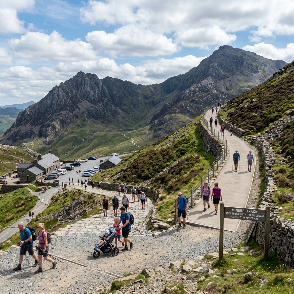
Route Overview
Pen‑y‑Pass is famous as the starting point for Snowdon’s toughest routes, but the lower valley access areas offer a surprisingly gentle, accessible experience with dramatic mountain scenery. These short, level paths around the car park and lower valley edge provide big views with minimal effort.
Why This Path Is Accessible
- Level, paved or compacted paths
- Wide turning areas
- Railings and clear edges
- Direct access from the car park
Who This Route Works Well For
- Wheelchair users
- Mobility scooters
- Visitors wanting mountain scenery without climbing
- Families with prams
- Photographers
Distance & Time
200–600 m, depending on the chosen area, 10–30 minutes
Nearby Accessible Alternatives
- Paved and compacted gravel
- Wide and well‑maintained
- No steps
Gradient & Elevation
- Mostly level
- Slight slopes near the car park edges
Facilities
- Large car park (accessible bays)
- Café and toilets (seasonal)
- Bus stop for Sherpa’r Wyddfa service
Navigation & Wayfinding
Paths radiate from the car park. Stick to the lower valley edges for the most accessible terrain.
Scenic Highlights
- Crib Goch and the Snowdon Horseshoe
- Glyderau peaks
- Dramatic U‑shaped valley
- High‑altitude atmosphere without the climb
Safety & Seasonal Notes
- Very exposed to the wind
- The weather changes rapidly
- Can be busy in the summer
Local Tips
- Sunrise and sunset are spectacular
- Sherpa buses reduce parking stress
How to Get There
Postcode: LL55 4NY
Nearby Accessible Alternatives
- Llanberis Valley Floor Path
- Llyn Padarn lakeside
Where to Explore Them
The 50 new routes will live inside the Access Trails Hub, organised by region and written in the full accessibility‑first format.
Explore the full UK & Ireland Accessible Landscapes Hub, your central place to browse by region, compare national parks, and jump straight into routes that match your needs.
Visit the Gateway to Accessible Routes Across the UK & Ireland to see every verified path in one place, with clear access notes, surfaces, gradients, and practical details that help you plan with confidence.
Access Trails hasn’t just added content, it’s been reorganised to make accessible walking easier to discover, easier to plan, and easier to trust.